Trail Mountain bike Le Poët-Sigillat - La Grande Javonière - Photo
 tracegps
tracegps

User

© OpenStreetMap contributors
Length
Length
13.9 km
Max alt
Max alt
856 m
Uphill gradient
Uphill gradient
486 m
Km-Effort
Km-Effort  
20 km
Min alt
Min alt
504 m
Downhill gradient
Downhill gradient
487 m
Boucle
Boucle
Yes
Creation date :
2014-12-10 00:00:00.0
Updated on :
2014-12-10 00:00:00.0

(0 Reviews)

Mountain bike
Mountain bike
2h00
Difficulty : Difficult

Scan this QR Code to open this trail in the SityTrail application

FREE GPS app for hiking

Logo SityTrail SityTrail

IGN / Geographical institutes

Download SityTrail from the App Store Download SityTrail from Google Play

Logo SityTrail SityTrail World

The world is yours!

Download SityTrail from the App Store Download SityTrail from Google Play Download SityTrail on Huawei AppGallery

About

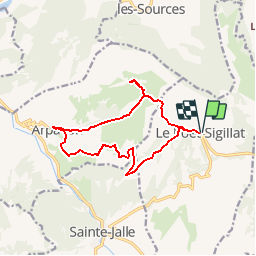
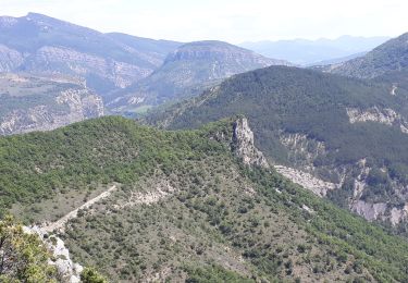
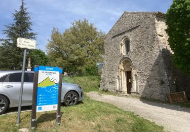
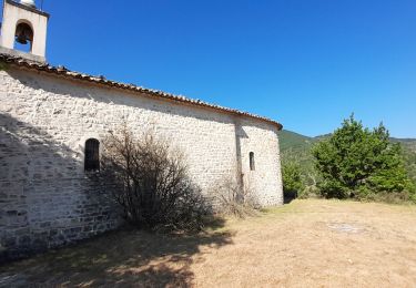
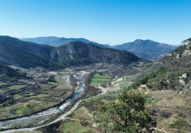
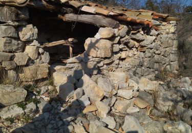
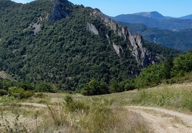
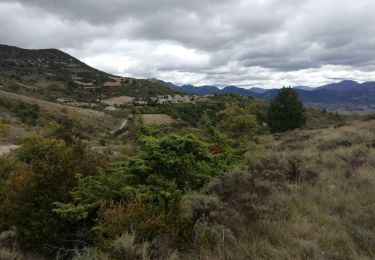
Trail Mountain bike of 13.9 km to be discovered at Auvergne-Rhône-Alpes, Drôme, Le Poët-Sigillat. This trail is proposed by tracegps.

Description

Belle balade entre deux beaux villages, le Poët sigillat et Arpavon aux parfums de lavande. Première partie en sentiers avec une belle descente vtt sur Arpavon. Deuxième partie sur piste. C'est une rando casse-croûte, plus de détails au gîte du Pré bossu.

Elevation profile

Photos

Positioning

Country:
France
Region :
Auvergne-Rhône-Alpes
Department/Province :
Drôme
Municipality :
Le Poët-Sigillat
Location:
Unknown
Start:(UTM)
684681 ; 4915533 (31T) N.

Trails nearby

Trail Walking Sahune - rocher de Bramard - Photo
Walking
GUIDE
nadinebondoux

Walking

Medium
Sahune, Auvergne-Rhône-Alpes, Drôme, France
12.4 km | 21 km-effort
4h 35min
Yes
Trail Walking Sahune - Sahune - Photo
Walking
tracegps

Walking

Medium
(2)
Sahune, Auvergne-Rhône-Alpes, Drôme, France
7.1 km | 12.5 km-effort
2h 30min
Yes
Trail Road bike Sainte-Jalle - Col d’Ey depuis Sainte Jalle via Rochebrune  - Photo
Road bike
Pierre Jongen

Road bike

Medium
Sainte-Jalle, Auvergne-Rhône-Alpes, Drôme, France
18.8 km | 24 km-effort
1h 55min
Yes
Trail Walking Arpavon - BruBer-Arpavon : ND Consolation - Photo
Walking
Bruno Berlemont

Walking

Medium
Arpavon, Auvergne-Rhône-Alpes, Drôme, France
5.5 km | 8.2 km-effort
1h 30min
Yes
Trail Walking Sahune - Asptt  SAHUNE VILLEPERDRIX - Photo
Walking
TOULAUDIN

Walking

Difficult
Sahune, Auvergne-Rhône-Alpes, Drôme, France
16.5 km | 27 km-effort
6h 29min
Yes
Trail Walking Sahune - 26 sahune - Photo
Walking
himba26100

Walking

Medium
Sahune, Auvergne-Rhône-Alpes, Drôme, France
19.5 km | 33 km-effort
7h 20min
No
Trail Walking Rémuzat - les Aiguilles en partant de Remuzat - Photo
Walking
nadd73

Walking

Medium
Rémuzat, Auvergne-Rhône-Alpes, Drôme, France
16 km | 29 km-effort
4h 45min
Yes
Trail Walking Le Poët-Sigillat - poët Sigillat-col de Soubeyrand-Tarendol - Photo
Walking
Bruno Berlemont

Walking

Medium
Le Poët-Sigillat, Auvergne-Rhône-Alpes, Drôme, France
12.9 km | 20 km-effort
3h 35min
Yes
Trail Walking Sainte-Jalle - GRP Baronnies Ste Jalle Arpavon 18km - Photo
Walking
GUIDE
thonyc

Walking

Medium
Sainte-Jalle, Auvergne-Rhône-Alpes, Drôme, France
18 km | 27 km-effort
5h 32min
Yes


Close
My subscriptions